Living off the Land
In this edition, Jamie Crawford uses aerial images to discover how the Scots have lived off the land over the centuries.
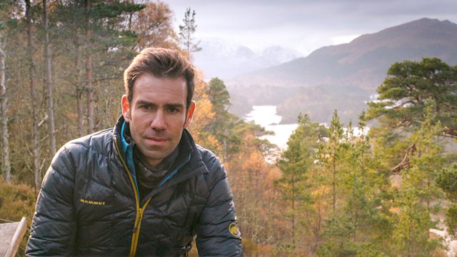
In this edition, Jamie Crawford uses aerial images to discover how the Scots have lived off the land over the centuries. He combines old aerial photographs with present-day drone and helicopter footage to tell a range of amazing tales, from the delicious whisky of Islay to the fertile fields of the Lothians. The island of Staffa is world-famous for Fingal’s Cave, but Jamie reveals that people have farmed this tiny and remote island for thousands of years. He lands by helicopter at the spectacular Iron Age hill fort Tap o’ Noth near Aberdeen to find out that thousands of trees were burnt during its destruction. His journey continues to Fort Augustus, where Jamie mountain bikes down the hairpin bends of the highest road in Scotland. It’s part of General Wade’s road network constructed across the Highlands in the 1730s. Plus a unique view from the top of a Scots pine in the ancient Caledonian forest at Glen Affric – considered one of our county’s most beautiful glens - to show what Scotland once looked like.
Last on
More episodes
Previous
Music Played
Timings (where shown) are from the start of the programme in hours and minutes
-
![]() 00:44
00:44Julian Fauth
Can't No Grave Hold My Body Down

Credits
| Role | Contributor |
|---|---|
| Presenter | James Crawford |
| Producer | Andrew Thompson |
| Executive Producer | Rachel Bell |
Broadcasts
 Wed 24 Apr 2019 21:00�������� One Scotland HD & Scotland only
 Tue 3 Sep 2019 20:00
- Wed 4 Sep 2019 19:00
- Thu 26 Mar 2020 20:00
 Sat 31 Oct 2020 18:00�������� Two Wales & Wales HD only
- Sat 31 Oct 2020 18:30�������� Two except Wales & Wales HD
- Mon 8 Feb 2021 20:00
- Tue 9 Feb 2021 19:00
- Wed 27 Jul 2022 20:00
- Mon 17 Jul 2023 20:00
- Wed 19 Jul 2023 19:00
- Thu 7 Mar 2024 16:15
Breathtaking panoramic 360° views of Scotland’s awe-inspiring scenery — a new perspective from drone-captured footage
Parts of Scotland you may already know, but won’t have seen like this before